
Page 9 - An-introduction-to-Svalbard
P. 9
Nordaustlandet. Svalbard's second largest island is situated in the northeast corner of this Arctic
archipelago. This part of Svalbard is wild, cold and inaccessible. The vast ice sheets Västfonna
and Austfonna cover some 75% of Nordaustlandet. Austfonna is the northern hemisphere's
third-largest ice cap, after the Greenland ice sheet and the Vatnajökull glacier on Iceland.
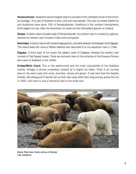
Storøya. A barren island situated east of Nordaustlandet. Its southern part is covered by a glacier,
whereas its northern part consists of bare rocks and gravel.
Barentsøya. A barren island with several large glaciers, situated between Spitsbergen and Edgeøya.
This island bears the name of Willem Barents who described it on his expedition here in 1596.
Edgeøya. A thick layer of ice covers the eastern parts of Edgeøya, whereas the western part
consists of flat topped mesas. There are remnants here of the activities of the Russian Pomors
who came to Svalbard in the 1600s.
Kvitøya/White Island. This is the easternmost and the most inaccessible of the Svalbard
islands. Kvitøya is almost completely covered by a mighty ice sheet. There is an ice-free
area on the west coast with rocks, boulders, stones and gravel. It was here that the Swedes
Andrée, Strindberg and Fraenkel set up their last camp after their long journey across the ice
in 1897, and there is now a memorial here to the three men.
Above: Polar bear meets walrus on Storøya.
Left: Austfonna.
9